Texas
Location, South Central Texas - Base City, Leakey, Texas.
Texas Hill Country roads illustrated here are considered to be the finest
motorcycling roads in the State of Texas.
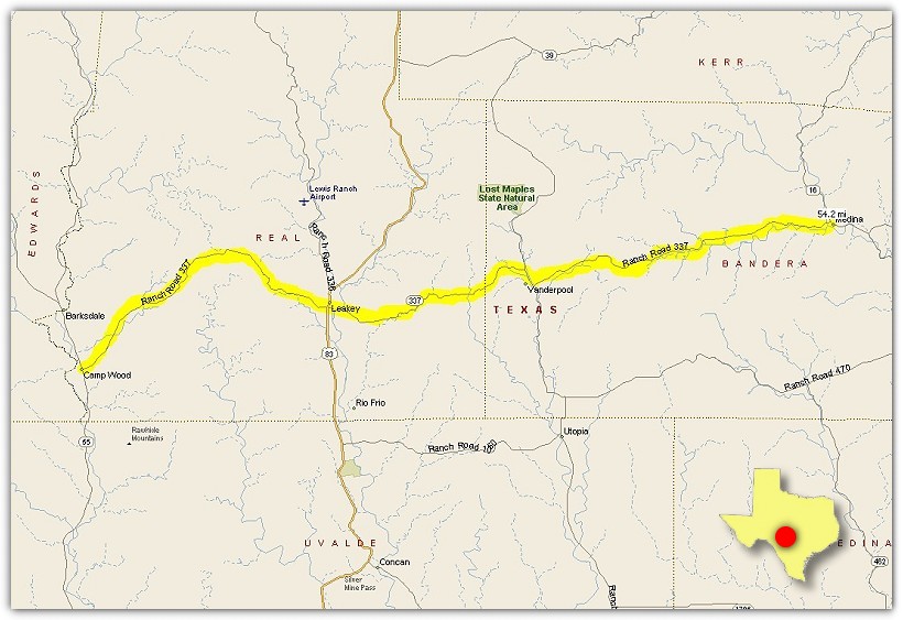
Ranch Road 337 - Voted best road in Texas.
Take Ranch Road 337 from Camp Wood through Leakey to Medina, Texas.
55 miles total one-way.

Ranch Road 335 and 336
From Leakey, take Ranch Road 336, go North to Highway 41. Turn left and take 335 South.
335 merges with Highway 55, continue South until you reach Camp Wood.
Take 337 East out of Camp Wood to Leakey.
Note: Be careful going over cattle guards on 336.
92 miles total.
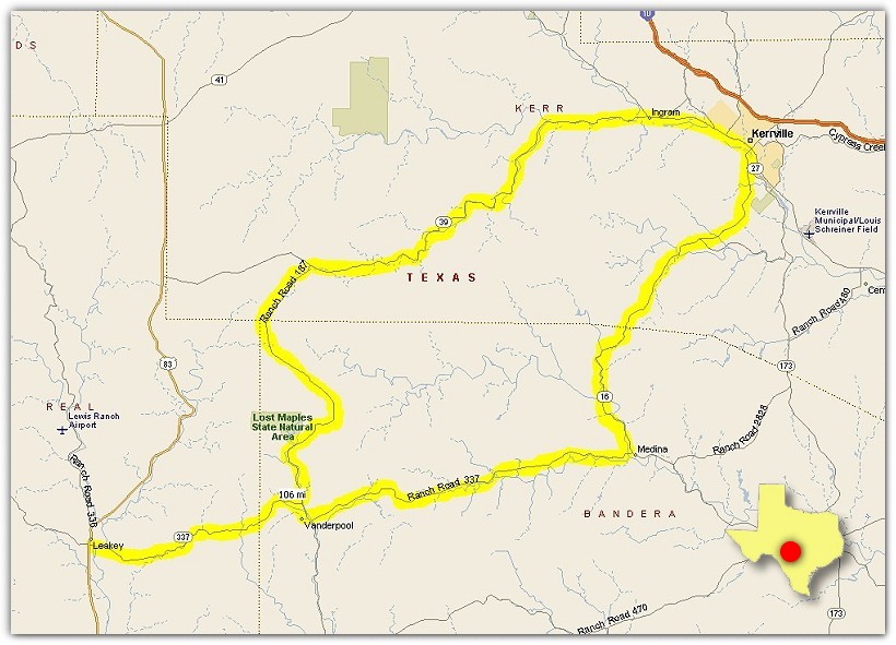
The Hunt Loop
From Leakey, take Ranch Road 337, go North on Ranch Road 187 (While on 187
stop and tour the Motorcycle Museum), then turn East on 39 through Hunt
(while in Hunt view Stonehenge II on RR 1340) to Kerrville.
Take 16 out of Kerrville to Medina. Take 337 West in to Leakey.
125 miles total.
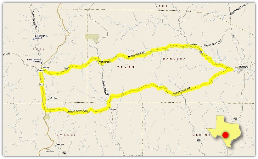
Utopia Loop
From Leakey, take Ranch Road 337 to Medina. Go South on 16 into Bandera.
Take 470 out of Bandera to Ranch Road 187 and go South into Utopia. Then take 1050 to Highway 83.
Go North on 83 to Leakey.
100 miles total.
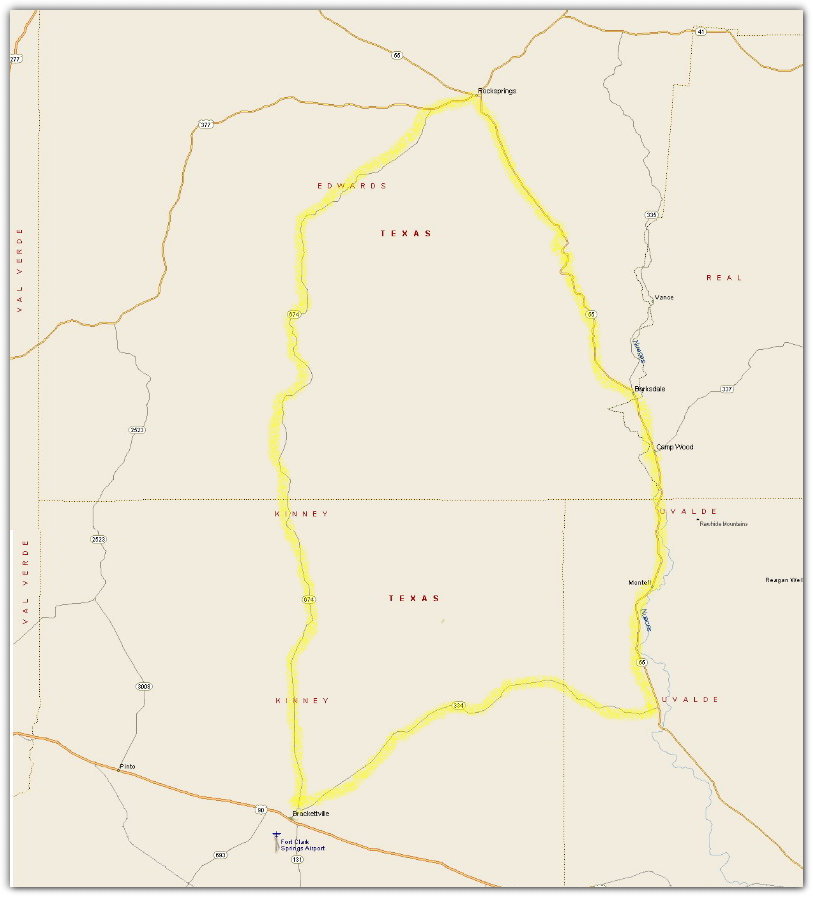
The Western Loop
From Camp Wood, take Highway 55 South then turn Southwest on RR 334.
In Brackettville, turn North on Highway 674. At the intersection of 377, turn right and travel into Rocksprings.
Then turn South on 55 back to Camp Wood.
130 miles total.
Location, Southwestern Texas - Base City, Alpine, Texas.
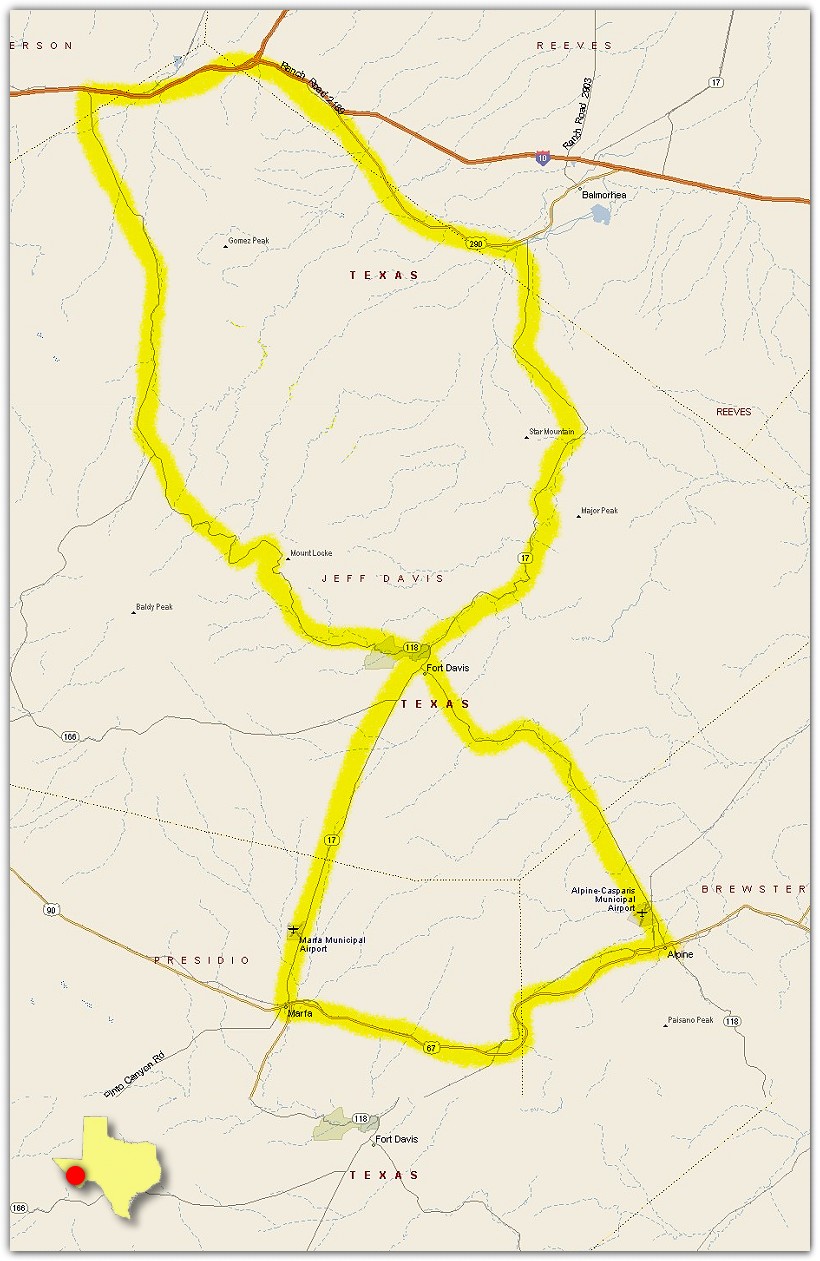
Figure 8
From Alpine, take Highway 67 to Marfa, then turn North on Highway 17. Continue on Highway 17
through Ft. Davis then turn left onto Highway 290. Traveling West on 290 get on I-10 and travel
to Highway 118. Take 118 South until you get to Ft. Davis. While traveling 118, stop and tour the
McDonald Observatory. Continue on 118 until you reach Alpine.
175 miles total.

Ft. Davis Loop
Take Highway 118 North out of Ft. Davis. Travel through the Davis Mountains State Park
and across Mt. Locke, turn left on Highway 166. Stay on 166 until you reach Highway 17.
Turn left into Ft. Davis.
72 miles total.
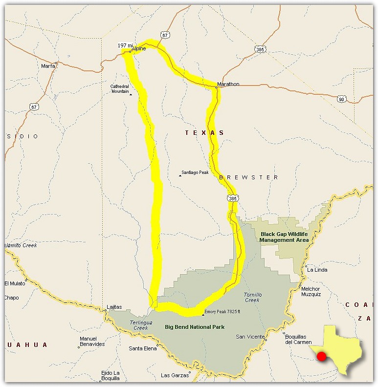
The Big Bend Tour
From Alpine, take Highway 90 to Marathon. Stop and eat breakfast at Shirley's Burnt Biscuit.
Travel Highway 385 out of Marathon South to Big Bend National Park. Tour "The Window" and Panther Peak.
See Emory Peak, tallest peak in the park. Travel Highway 118 out of Big Bend to Study Butte.
Stay on 118 until you reach Alpine.
197 miles total.
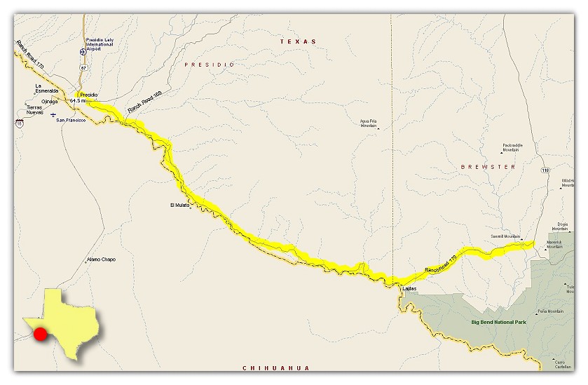
The River Road
From Study Butte, take Highway 170 West to Presidio.
This road can be treacherous in the heat of the summer or when it rains heavily
as sand and dirt will fill portions of the road.
65 miles total one-way.
Location, Northeastern/Eastern Texas - Base City, Tyler/Longview, Texas.
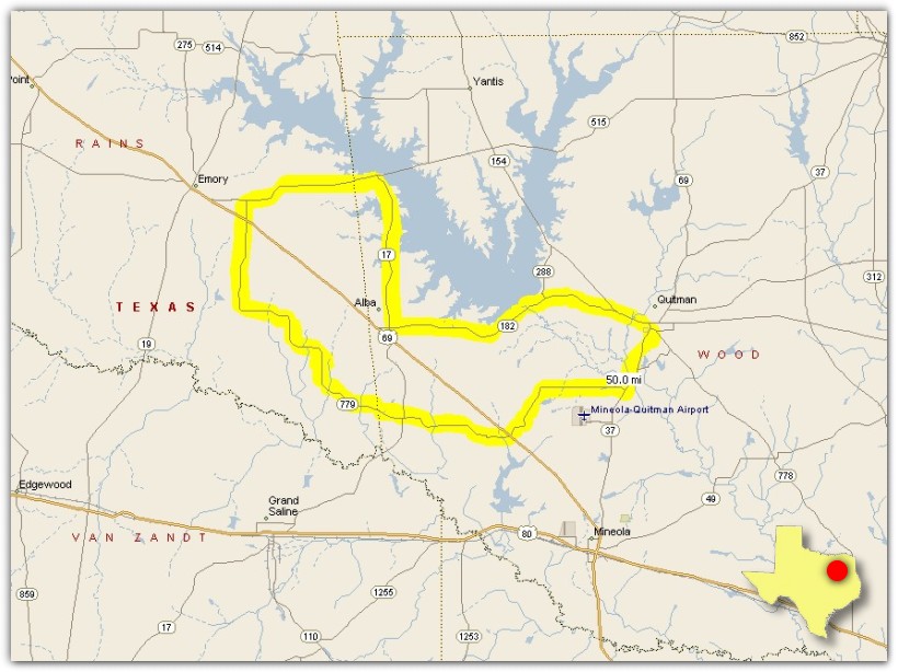
The Golden Road
Out of Quitman, Texas take Highway 37 South to FM 779. Stay on 779 through
Golden, Texas and go across Highway 69 to Highway 515. Turn right at Highway 17 and continue
until you get to Highway 182 then turn left onto 182. 182 later merges with Highway 154 that
will take you back into Quitman.
This route sports some nice sweepers on 779 as well as a good look at Lake Fork and the Lake Fork Dam.
50 miles total.
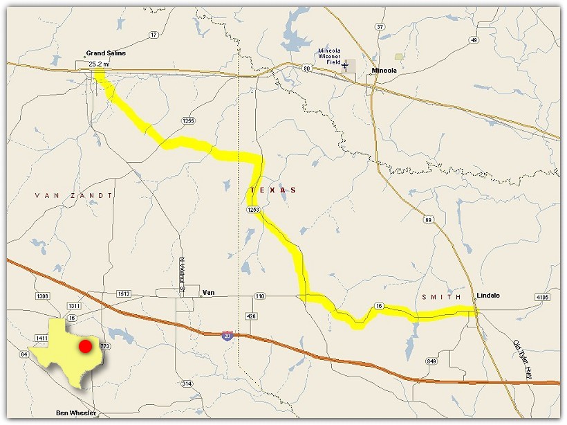
The Providence Road
From Lindale, take Highway 16 heading West until the intersection of 1253 is reached.
Turn right (North) on 1253 and travel through Jamestown until you reach FM 857. Take a left
onto 857 which will take you through Providence, Texas and will end up in Grand Saline.
25 miles total one-way.
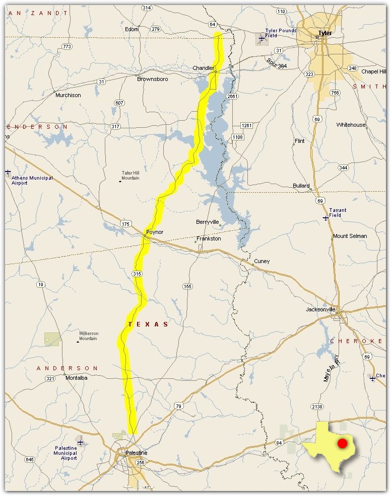
The Poyner Byway
Off FM Road 279, take FM 315 heading South. 315 is a beautiful road that runs across
Lake Palestine and through Poyner, Texas and ends up in Palestine, Texas.
45 miles total one-way.
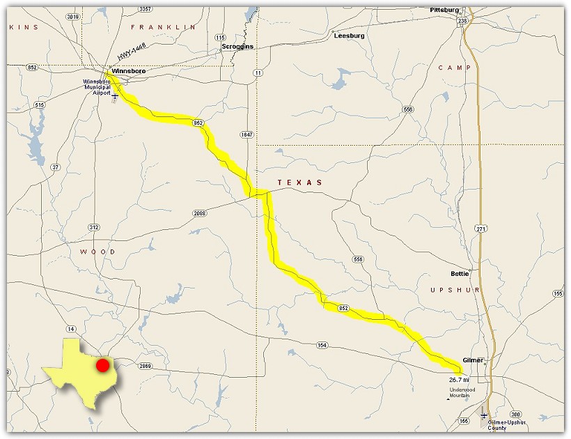
Ride Through Perryville
From Winnsboro, take FM 852 running South. 852 is a perfect road to ride during the
Fall of the year. 852 runs through Perryville where a small jog to the left then the right
will put you on track to arrive on Highway 154 near Gilmer.
27 miles total one-way.
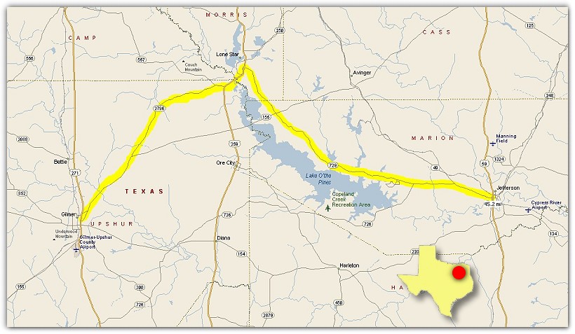
The Jefferson Run
Out of Gilmer go East on Highway 155 then veer left onto Highway 2796. Take 2796 until you
reach Highway 259. Turn left (North) on 259 and turn right onto 729. Take 729 all the way
into Jefferson. This is a good ride in the Spring or Fall.
45 miles miles total one-way.
Location, Central Texas - Base City, Austin, Texas.
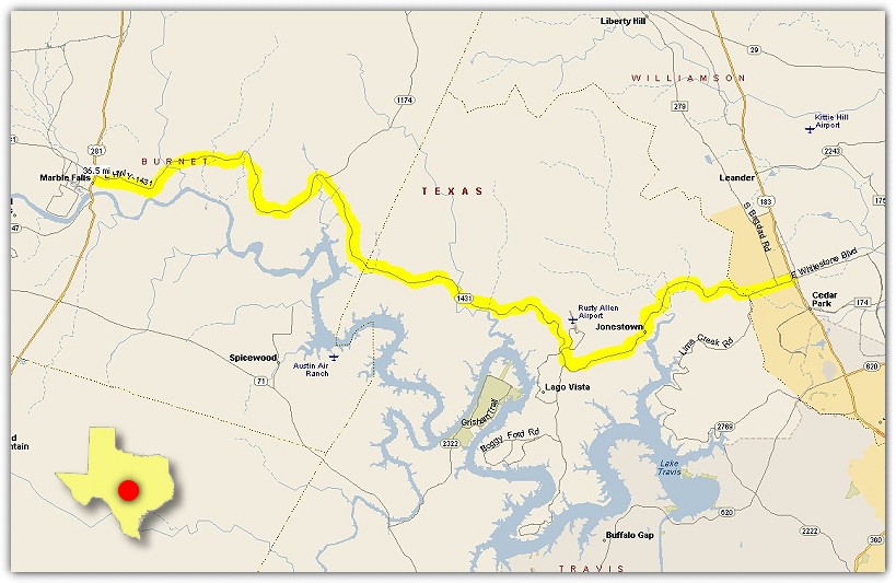
The Marble Falls Run
From Cedar Park off Highway 183, take Highway 1431 through Jonestown and across the lake
to Marble Falls, Texas. Once in Marble Falls, take a left and find the Blue Bonnet Cafe for
some of the best pie in the land!
37 miles total one-way.
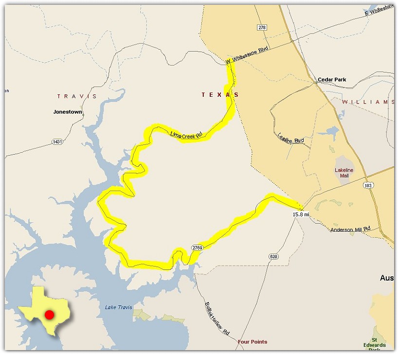
Lime Creek Road
From Highway 1431 in Cedar Park, take Lime Creek Road (Highway 2769) until it ends into Highway 620.
Lime Creek Road is famous for its switchbacks and curves around Lake Travis.
16 miles total one-way.